
Useful Apps
There are some amazing apps that can definitely make a skipper’s life that little bit easier. Here are a few of the apps that I and the other HPYC skippers and instructors use regularly. We will add to this list in future articles.
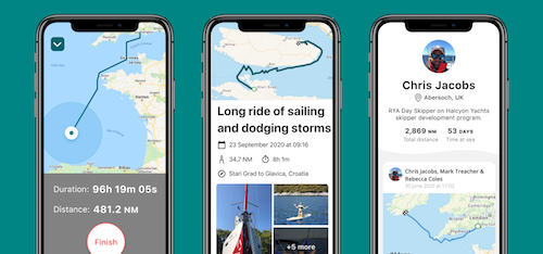
SailTies
We recommend downloading SailTies, the free app to capture and share sailing voyages and build your sailor profile.
The public link to this page is: https://sailties.net/group/
![]()
![]()
Imray Tides Planner
![]() If we only had space on my smart phone for one app it would be this one. Not only does it contain the tidal heights for standard and secondary ports around the world, this app will work out the height of tide at any given time simply by choosing a port, a date and then moving the slider. One of its less well known features is the built-in Tidal Atlas for the UK, Channel Islands, North Sea and Biscay Coast. Choose a chart and a date and then scroll through the tidal hours. The app shows you the springs or neaps rates for any tidal hour – a far quicker alternative to a pesky tidal ladder!
If we only had space on my smart phone for one app it would be this one. Not only does it contain the tidal heights for standard and secondary ports around the world, this app will work out the height of tide at any given time simply by choosing a port, a date and then moving the slider. One of its less well known features is the built-in Tidal Atlas for the UK, Channel Islands, North Sea and Biscay Coast. Choose a chart and a date and then scroll through the tidal hours. The app shows you the springs or neaps rates for any tidal hour – a far quicker alternative to a pesky tidal ladder!
The basic app is free but this only shows the current day’s tide table. Getting UK, Ireland and German tide tables for any date in the future costs £5.99. The interactive tidal stream atlas costs £5.99 and is valid for any future date.
![]()
![]()
Solent Met
![]() Ever wondered why the wind in Hamble Point Marina doesn’t bear any resemblance to the forecast? The SolentMet app relays live weather data from buoys on Bramble Bank, at the top of Southampton Water and at the entrance to Chichester harbour. The app gives you the speed and direction of wind and gusts. BrambleMet also provides visibility data and Chichester gives wave height. Well worth a quick check before setting sail or if you’re wondering whether to set a reef before leaving.
Ever wondered why the wind in Hamble Point Marina doesn’t bear any resemblance to the forecast? The SolentMet app relays live weather data from buoys on Bramble Bank, at the top of Southampton Water and at the entrance to Chichester harbour. The app gives you the speed and direction of wind and gusts. BrambleMet also provides visibility data and Chichester gives wave height. Well worth a quick check before setting sail or if you’re wondering whether to set a reef before leaving.
![]()
![]()
Navionics
![]() Navionics now has a much simpler approach – a single app via which you purchase the chart areas that you need. The charts aren’t cheap but they are very detailed, kept up-to-date and useful for passage planning and monitoring. Navionics charts are used in many of the on-board chartplotters including Raymarine, B&G, Lowrance and Simrad so they are well maintained. Navionics is continuously adding new functionality to the app.
Navionics now has a much simpler approach – a single app via which you purchase the chart areas that you need. The charts aren’t cheap but they are very detailed, kept up-to-date and useful for passage planning and monitoring. Navionics charts are used in many of the on-board chartplotters including Raymarine, B&G, Lowrance and Simrad so they are well maintained. Navionics is continuously adding new functionality to the app.
![]()
![]()
Google Earth
![]() Charts, pilot books and almanacs contain stacks of information and are the key tools for planning any passage. Add Google Earth to the mix and you can get an extra layer of information before arriving somewhere new. The satellite views of an entrance or layout of a marina or anchorage can really help you to visualise the place and enhance your pilotage plan.
Charts, pilot books and almanacs contain stacks of information and are the key tools for planning any passage. Add Google Earth to the mix and you can get an extra layer of information before arriving somewhere new. The satellite views of an entrance or layout of a marina or anchorage can really help you to visualise the place and enhance your pilotage plan.
![]()
![]()
CONTACT US
WHAT CLIENTS SAY
This is truly a 5 * service. The team really looked after us both ashore on arrival and also while at sea. We were a relatively inexperienced crew but always felt the team ashore had our backs. Thoroughly recommended.
I just wanted to say Thank-you very much for the weekend charter. It was exactly what we were after (albeit cold!) plus Andy was an awesome teacher and great company. We’ll definitely be keen to book again soon!
We had a fabulous four days. Marina is ideally placed for the Solent, boat was in great condition, well equipped and a joy to sail. We were well briefed and the shore side team including the dog very friendly.
We charted one of the sailing yachts for a fantastic weekend cruise in the Solent. The boat was in superb condition and well equipped, the staff was very helpful explaining how things work on the yacht and there was also a video available with all the important information. 10/10 would recommend!
Had a fantastic week chartering Blue Otter, Alex was incredibly helpful and sent loads of information and date checking prior to booking. There was a handover video and both the handover and return were really smooth. The boat was lovely and well maintained and Lee was really helpful in recommending places to visit (and helping identify the steering issue as an autopilot takeover - doh!). Definitely will be back and would fully recommend!
Just back from a lovely week in the Solent. Great service from HPYC from first inquiry through to return handover. Very straightforward to deal with, and the yacht was in excellent condition. We've chartered from many companies in the UK and abroad and the attention to detail (and flawless inventory!) was second to none. Everything about the yacht and equipment had clearly been well looked after and was in immaculate condition. Great service, will use again.
Always very friendly service, and well-maintained yachts. Easy check-in and checkout. Will be back...
We had a great time and were very happy with everything. Your team were genuinely friendly and were very helpful when we needed it. Is a big contrast to many charter companies I have dealt with in the past.
Watching the sun go down with a glass of bubbly on the deck of a sparkling yacht was unbelievable. What a treat, and a much needed change of scenery in these troubled times. We will be back for sure
Fab service, nothing too much trouble, including my daft questions. I'll be a repeat customer for sure!
We had a great time sailing with Lee for a few days at the beginning of September. Hamble Point Yacht Charters supplied us an impeccable 45 ft Hanse yacht, which was handled with complete mastery by Captain Lee. It was a privilege to sail with Lee, who is clearly a highly skilled professional taking great pride in his work ... but who is also a fantastic character with a great sense of humour and plenty of fun stories to keep the whole family entertained. He balances the serious side of safety and learning about sailing with a whopping dose of amusement and good cheer. We sailed the Solent in some decent seas, visited Bucklers Hard on the banks of the Beaulieu River and learned lots about British nautical history. Our boys started somewhat of a fishing trend catching bass off the back of the boat in Portsmouth and we would love to sail with Lee again in the future. The man truly knows his stuff, maintained the boat impeccably and went to every effort to ensure that we had a great time. Many thanks to “Shippers” and Hamble Point Charters. We’ll be back.
Chartered bareboats with HPYC on numerous occasions most recently in Sept 2020. Always helpful and accommodating. Highly recommend.
We had a fantastic weekend sailing on Loxley B. Boat in super condition and spotlessly clean, Alex. and the team very thorough and always on hand to answer any questions. A great experience. We will be back. Thank you!
Lots of information from office with a friendly service. We selected a one of the cheaper yachts and was please with find everything work and was cleaned and tidy. We will definitely be back
This was the first time we had tried chartering and as experienced racing sailors we didn't know what to expect. Covid has closed down all our events this year so this was a chance to get afloat at least once in 2020. What a great experience and Alex and all the Hamble staff could not have been more friendly or helpful. We had a great three days and we will be back !! We would have no hesitation is recommending Hamble Point Yacht Charters.